


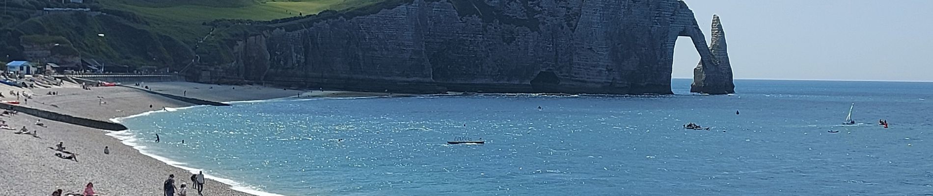
20250611 Le Tilleul Etretat Benouville

Childebert
Gebruiker
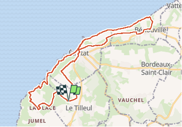

Lengte
21 km

Max. hoogte
108 m

Positief hoogteverschil
376 m
Km-Effort
26 km

Min. hoogte
3 m

Negatief hoogteverschil
376 m
Boucle
Ja
Datum van aanmaak :
2025-06-11 07:15:04.764
Laatste wijziging :
2025-06-11 16:09:53.622
7h33
Moeilijkheid : Moeilijk

Gratisgps-wandelapplicatie
 SityTrail
IGN / Geografische instituten
SityTrail Plus
De wereld gaat voor u open
Over ons
Tocht Stappen van 21 km beschikbaar op Normandië, Seine-Maritime, Le Tilleul. Deze tocht wordt voorgesteld door Childebert.
Foto's

Plaatsbepaling
Land:
France
Regio :
Normandië
Departement/Provincie :
Seine-Maritime
Gemeente :
Le Tilleul
Locatie:
Unknown
Vertrek:(Dec)
Vertrek:(UTM)
297783 ; 5507535 (31U) N.
Opmerkingen